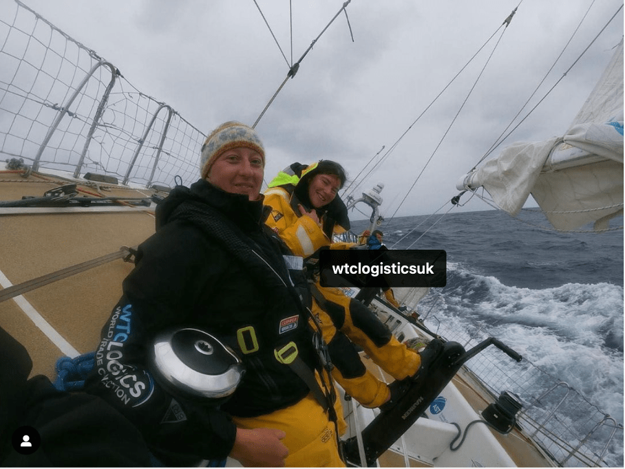
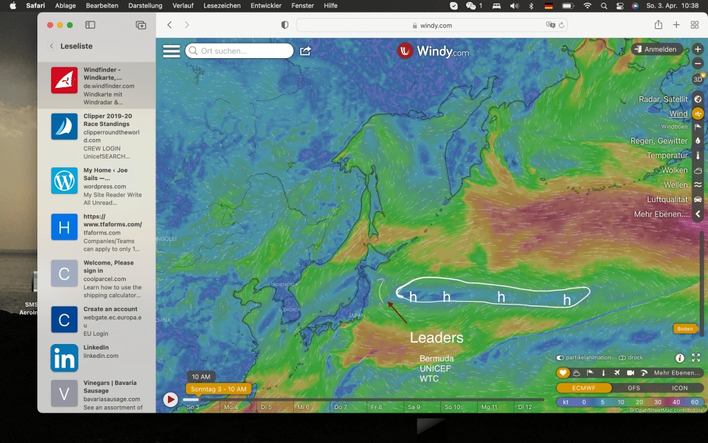
The fleet of Clipper round the World race is now 10 days and 11 hours into racing in the mighty Pacific. They worked their way up from the North tip of Lucon (Philippines) along the coats of Taiwan following the coast of Japan having sailed now 2000 nm of the 6100nm journey. 1/3rd of the trip is behind them and still no bar or bus stop in sight.. In the current standings Bermuda is first leading by just a mile over UNICEF followed by WTC Logistic, my crew!
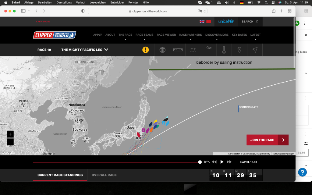
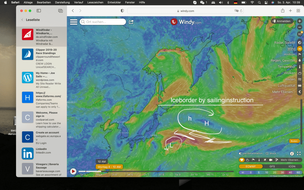
The white line is the giant circle, the shortest direction from the start line to Seattle. To the East it will be limited in the North by 45 degrees Latitude as this was the declared the ice limit by the sailing instruction.
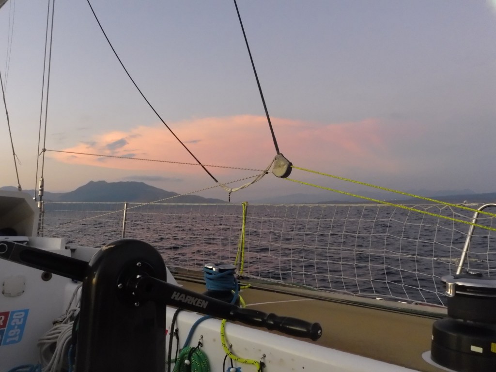
The ranking is measured by the direction to the finish line in relation to the white line. Therefore UNICEF is still in second place. But now it is all about positioning, weather windows and weather development. It will be a tough tactical battle over the next 5 to 6 days as weather is developing fast and forecasts are changing half daily. It is really interesting to watch it ashore in our cozy apartments considering that it is a real challenge in the grey, cold and wet conditions out there. How does it look right now? Temperature is around 9 Degrees Celsius (50F), the sky is gray, the boat healed over on Starboard tack at an angle of 45 degrees with a full sail plan. Speeds are between 6.5 and 8.5 knots. The boats are punching North.
Weather reading is an essential tool for being fast and smart and drives to a good result.
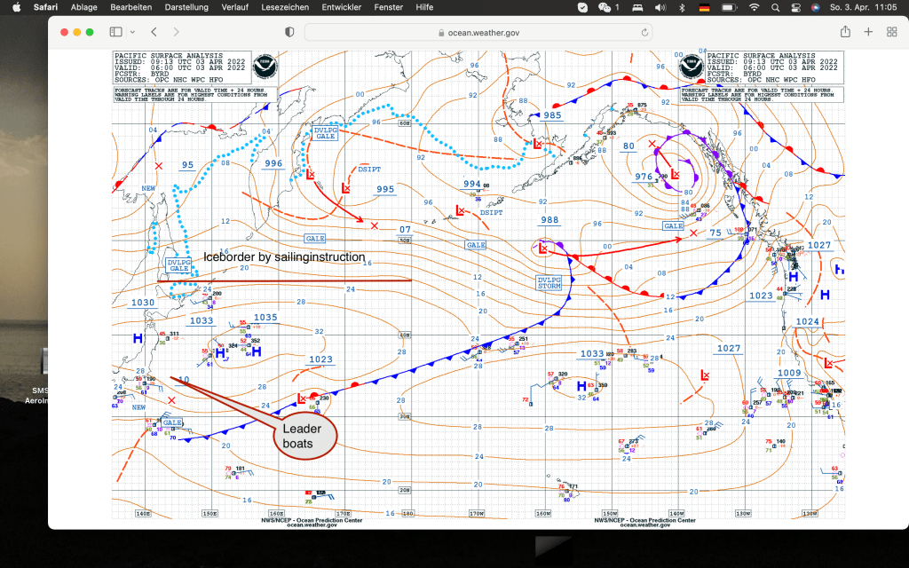
This is the actual weather chart from the North Pacific as of today. Combine it with the wind forecast and the picture becomes clear for the moment.
A High pressure system with 1036mb is East of Japan and a low pressure system is forming South of it (later more about this). The ridge is slowly moving Eastward. In the forecast models yesterday the movement was straight to the East. This morning the models show a movement to the Northeast.
Based on the model you see here the tactical decision is obvious. Try to get North as fast as possible making as much East as practical. The amount of East movement will be dictated by how much East the High moves. The goal is to stay in a moderate breeze and to get to the North of the High between the ice limit and the high and then turn due East.
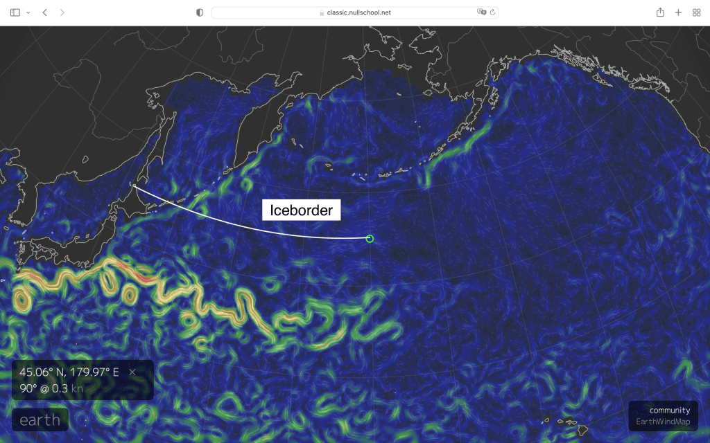
Why? South of the High you see a strong wind field. This wind field will turn into a low pressure system. Wind is from the East forecasted over the next 24 hours to increase to 8Bft. The sea state is hilarious there with waves up to 6m. You don’t want to beat up against the wind in that sea state. The sea state is part of the strong wind caused by the compressed isobars between the High and the forming low. And secondly you have strong currents flowing to the East as part of the Pacific Vortex. Here is the sea current live picture from this morning:
So clearly wind against current equals chaos. Before going to the forecast and the development of the next 48 hours let’s review where the fleet stands. As mentioned above the crews are 10.5 days in the race. Almost all of the distance closed hauled and at a boat angle of 45 degrees. They will carefully manage their energy as this type of sailing over such a long time causes fatigue very easily. Sleeping is a problem because of the banging noise, it is not warm and helming requires all the concentration.
Following the tracker you can see that Qingdao is heading back to Japan. They have a damaged running backstay. It is a vital piece of fear holding the mast in upwind conditions. It seems they cannot repair int at sea. And in order not to take any risk they make a stop over on Yokohama.
This backstay is tightened clause hauled and stabilizes the mast. Losing it especially with 4000 miles ahead is not good. and as safety is number one for al area, AQP, skippers and Clipper a return to harbor is painful.
There was another mishap on Imagine your Korea before but it seems that has been sorted as Imagine your Korea is in race mode going up the coast of Japan.
What is ahead?
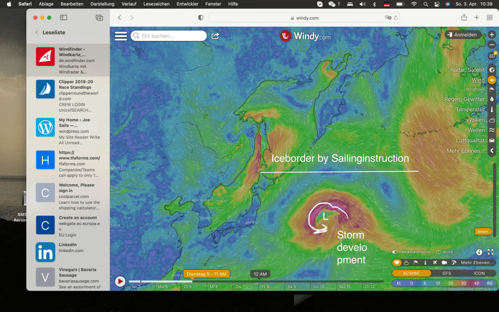
This is in 24h. The High pressure system moves East but also more North than forecasted yesterday. There is still room to the ice border. In the South of it you can see how the Low is developing and the wind and sea state increases. This is in 24 hours.
The forecast weather map for the weather in 48 hours looks like this:
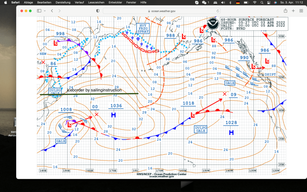
The low is forecasted to move NorthEast. The wind forecast looks like this:
We will need to have a close look at this as this is a change over yesterdays models and maybe the champaign sailing conditions that I predicted for the next three days will look different. The option trying to go North now and see how the Low will develop is in my opinion still correct as sea state and wind does not allow to cross the high in the South. But we need to keep an eye on the Low.
I am very happy about the progress of my team. Being where they are show that they have a very good sense for weather analysis, tactics, a solid strategic plan and much more than anything a highly motivated crew that plays team. Go EWTC, go!

